Search
Close this search box.

A Timeline of Vine Road

Over time, the area now known as Vine Road Recreation Ground, or more recently, Vine Road Park, has had many names and holds many stories and secrets.

In 925, King Athelstan gives Barnes, formerly part of the Manor of Mortlake, is given to the Dean and Chapter of St Paul’s Cathedral, who remain landowners to this day.

From Elond (land by the ‘ea’ or stream) in 1461 to ‘Iland’ in 1519; ‘Elandes’ in 1523; ‘Ealands early in the 1800’s and ‘Island’ right up until the end of the that century, when its southeast boundary was a simple lane, now known as Vine Road.

So when and why did the lane become Vine Road?

Barnes Commoners (copyholders of the manor) agree to sell 10 linear acres of the Common at £200 an acre.

This enables railway work to continue west, through market gardens between the Beverley Brook and the lane now called Vine Road, slicing through the market gardens of William Clifford and Charles Barker (now Vine Road recreation ground and The Elms).

An Act for extending the railway ‘with a Loop Line through Brentford and Hounslow’ is passed, taking another slice of the Common and boxing in the orchards of Charles Barker (Vine Road Recreation Ground).
OS map marks what we know today as Vine Road simply as ‘a lane’
Vine Cottage is named on the OS map.
Vine Road is named on Delineation map.
The Amenities Committee of the Barnes, Mortlake and East Sheen Ratepayers’ Association express concern that the agricultural estate between the level crossings may come up for public sale. No action is taken and the Council is asked to reconsider at a subsequent meeting.
Enquiries made by the Finance Committee, who are advised that the land is not for sale. However, soon after, the land was soon sold to Mr Walter Barker (renowned market garden family).
Council negotiates with Executors of Walter Barker’s estate, and acquire the 5.5 acres at a cost of £700 per acre, known at this time as ‘The Orchard’. The area was agreed for use as playing fields to include a bowling green and cricket ground but no football or tennis facilities.
Sports Ground complete with plans still in hand for the pavilion with estimated cost of £1500.
Following negotiations with Joseph Pither of 68 Railway Side, a piece of his land 10’ x 55’ is purchased by the Recreation Ground for £100 and an agreement is made to erect a 2m fence between the land and his remaining garden. To this day, this land provides the main pedestrian access from Railway Side.
Over the next thirteen years, seasonal fruit pickers are hired to harvest the orchard fruits.
Paddling Pool constructed.
Deemed no longer viable to employ fruit pickers, the Borough Surveyor is authorised to remove all dead trees and attempt to preserve where possible.
Additional play equipment provided.
The site is taken out of rating and recommended that it be ‘…. dedicated to the perpetual use and enjoyment of the inhabitants of the said Borough’
The decision is taken to cut down remaining fruit trees and replace with amenity trees, likely to be many that we still see today.
Under the London Government Act 1963, the Boroughs of Barnes, Richmond & Twickenham are merged to form the London Borough of Richmond upon Thames (LBRuT).
Tea room serving refreshments from the pavilion stops.
Montessori Nursery School is founded.
The bowling green is last used – by a croquet club.
Friends of Barnes Common is offered storage yard/office space and use of the Pavilion.
Pavilion and public toilets refurbished with funding from Friends of Barnes Common and LBRuT. The Paddling Pool was also re-lined at this time.

The family of Joseph Pither plants a fruit tree at Vine Road to commemorate his contribution and love of the area.

Richmond Community Fund awards £29,000 for a Feasibility Study to develop a proposal, undertake public consultation and create detailed design for the Vine Road refurbishment project.

Just three fruit trees remain from the earlier market garden/orchard days: an apple and two pears.

References

Highways & Byways of Barnes, Grimwade M & Hailstone C; 1992; 2014

Plans of the City of London and Richmond Railway in Highways & Byways of Barnes (as above)

Urban District Council of Barnes Minutes 1928 – 1959 as in Vine Road Recreation Ground; Merle Harding 2012

Wiki History accessed 24/01/2020

1836 Tithe Map

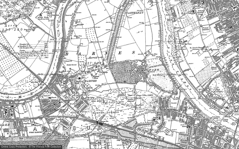
1893 OS Map: Barnes Common County Edition

1867 OS map re-produced by Alan Godfrey Maps

1898 Board of Agriculture definitive map of Barnes Common

Related links

History