
During the recent period of prolonged, moderately heavy rainfall, parts of the Green experienced temporary flooding. This is a natural function of a flood plain. Importantly, unlike before the recent works, the water drained away quickly once the brook level fell.
What caused the high water level?
The level of the brook as it passes Barnes Green is normally affected by three main factors: the amount of rainfall, the sluice gate at Westfields, and high tides from the Thames. But it seems that this time there was something else as well: a large branch/tree was caught in the structure called Ashlone Wharf in Putney according to the Environment Agency. “At high tide, this caused very high levels in the Beverley Brook” – the agency stated. “The field team and duty officers responded accordingly and removed the debris the same day. The field team also lowered Westfields Sluice to assist with reducing the water level. The sluice was adjusted back to its normal operating position yesterday morning [4 February].”
Will the Green flood again?
The Green lies within a natural flood plain, meaning it is designed to hold excess water during heavy or prolonged rainfall. Temporary flooding in these areas helps reduce pressure on the river system and lowers flood risk elsewhere.
The recent flooding, while understandably concerning, shows that the system is working as intended — and draining as it should.
What affects water levels in the brook?
1. Rainfall upstream
The brook responds very quickly to rain, with levels rising within around 30 minutes and usually peaking as rainfall eases. Water levels then typically fall again over the next 16–24 hours.
2. The sluice gate at Westfields
The sluice gate controls how much water flows downstream. It is normally set to allow a steady flow, with excess water diverted through culverts directly to the Thames. During very wet conditions, water can temporarily back up behind the sluice before increased pressure forces more flow through the system.
3. Tides in the River Thames
When tides are high, water from the brook and culverts cannot drain freely into the Thames. Non-return valves close to prevent river water flowing back upstream, causing water to back up in the system (known as “tide lock”). Recent tides have been higher than normal due to both tidal cycles and increased river flows following heavy rainfall. Once the tide falls, drainage resumes naturally.
Managing where water is temporarily stored during these conditions is a delicate balancing act.
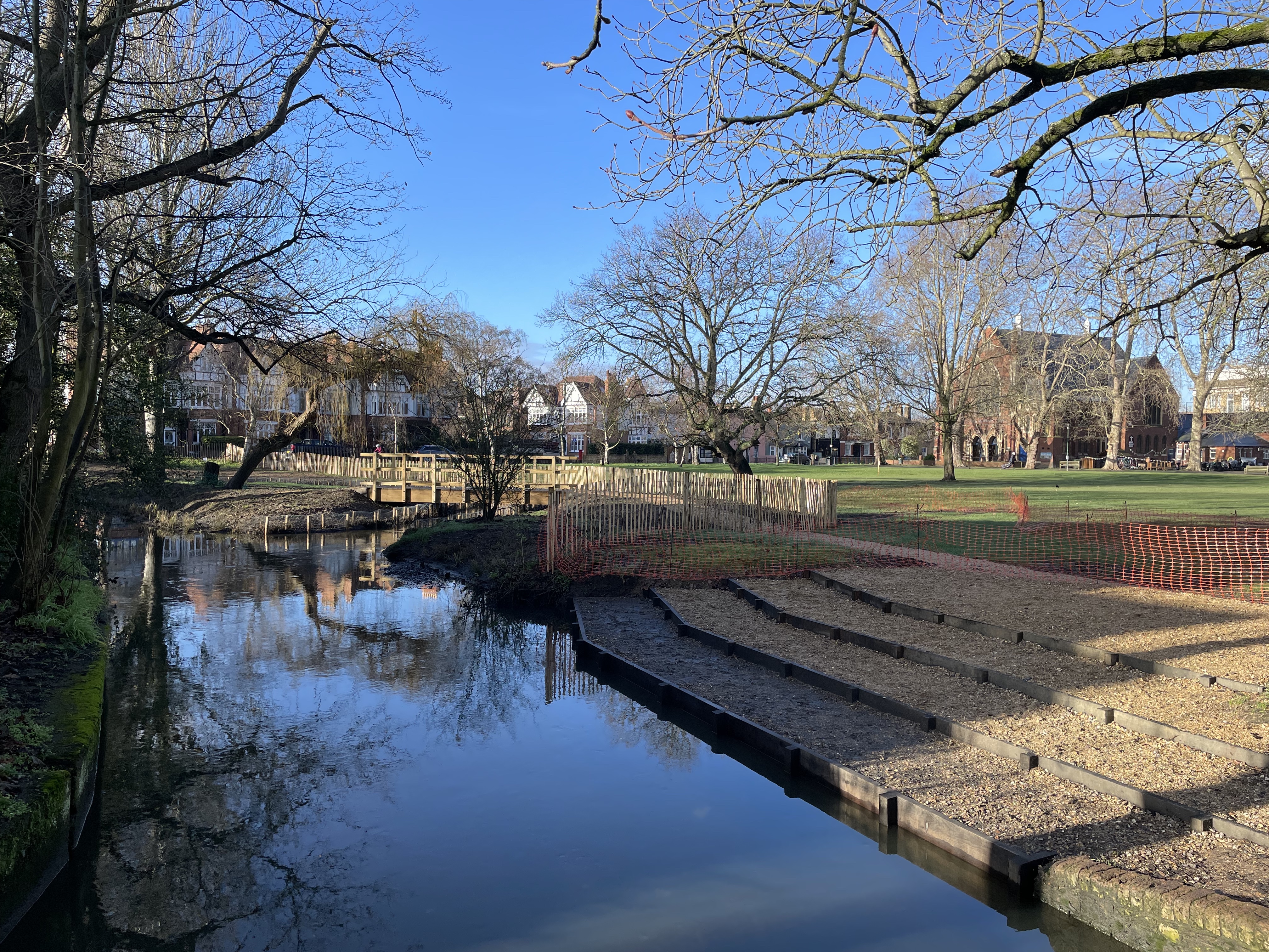
What recent improvements have achieved
The new channel, working alongside the existing one, has increased the system’s capacity to hold water before flooding occurs. French drains beneath the Green also helped water soak away more efficiently. These work well in normal and moderate conditions but are less effective when the ground becomes fully saturated during prolonged heavy rain. They reopen automatically as river levels fall.
What happens next
Community BlueScapes continues to monitor the system closely and is planning further projects upstream and downstream. These aim to increase water storage in areas where flooding does not threaten property and to improve long-term resilience as climate change brings heavier rainfall and higher tides.
While the recent flooding was inconvenient, it was short-lived and expected under exceptional weather conditions. The restoration has been designed to work with natural water processes, improving flood management and environmental benefits for the community.
Working in partnership with the London Borough of Richmond upon Thames (LBRuT) and the Wildfowl and Wetlands Trust (WWT), we have been awarded £6m from the Department of Environment, Food and Rural Affairs (DEFRA) to increase flood resilience in the Beverley Brook’s catchment in Richmond and areas of Wandsworth. The Community BlueScapes project runs over 6 years and is part of the £200m Flood and Coastal Resilience and Innovation Programme, managed by the Environment Agency (EA). We were one of 25 programmes selected to drive innovation in flood and coastal resilience and adaptation to a changing climate, across the country.