

Putting the Common’s Lowland Acid Grasslands on the map
We have now completed detailed habitat mapping of the lowland acid grassland across the Common, following ten days of survey work. Lowland Acid Grassland (LAG) is an important and increasingly scarce habitat, characterised by a distinctive assemblage of fine grasses, flowering plants and invertebrates adapted to nutrient-poor, sandy and acidic soils. Mapping the current extent of this habitat gives us a much clearer picture of the distribution across the Common and provides an important baseline for monitoring change over time.
The mapping is already helping us identify areas where restoration or management intervention is needed. Without appropriate management, acid grassland can gradually be lost as coarse grasses and bramble shade out the smaller and less competitive plants. By understanding the extent and condition, we can target management more effectively and look for opportunities to reconnect fragmented patches.
We are also recording indicator plant species and features to helps us understand quality and ecological condition. It will allow us to identify particularly important areas, monitorchanges in plant populations and ensure that future management protects the most sensitive species. Mill Hill alone supports more than 1,000 Yellow Meadow Ant hills, creating small scale variations in soil and vegetation that add to the structural diversity of the grassland.
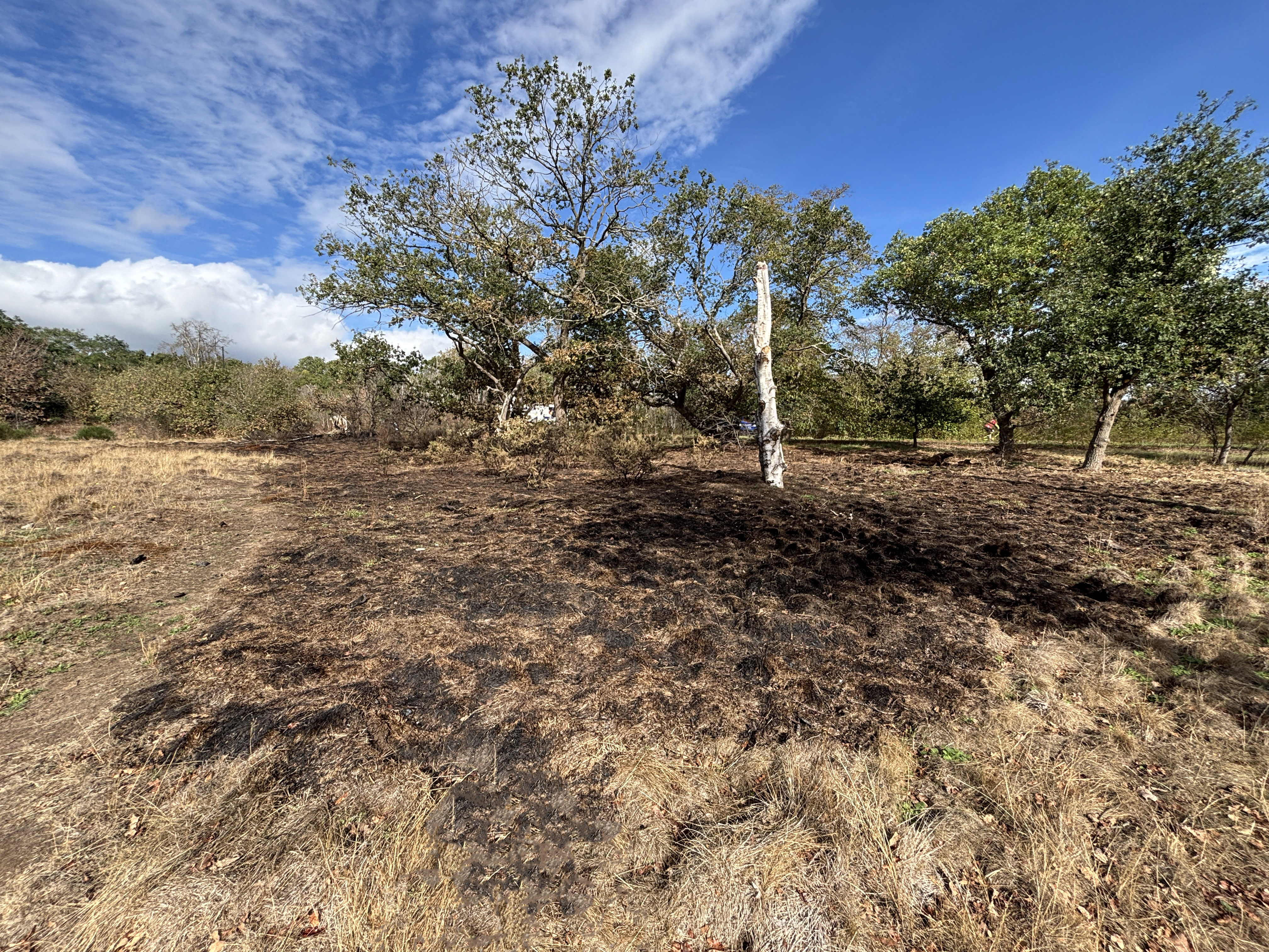
This year has highlighted just how vulnerable these habitats can be. The prolonged drought and hot, dry weather have been extremely challenging and have greatly increased the risk of fire. Four fires have affected areas of LAG at Mill Hill and Rocks Lane this year alone, causing significant damage and destroying valuable habitat.
If hotter, drier summers become more frequent, managing the risk and impact of urban wildfires will become an increasingly important part of conserving the Common. We are therefore considering how habitat management, monitoring and other measures can help minimise the damage caused by future fire events while continuing to protect the ecological value of these special grasslands.
Restoring the Common’s Wildflowers
This year we have taken part in the BSBI Flowers Count survey, which has helped us to identify areas of Barnes Common where there are opportunities to enhance floral diversity and provide more resources for pollinators. Our focus includes woodland rides, lowland acid grassland, meadows and the margins of ponds. These habitats support distinctive plant communities and, importantly, some of the plants growing around pond margins continued to flower and provide valuable nectar and pollen during the drought this summer. Increasing the diversity and abundance of native flowering plants is an important part of our conservation work. A greater variety of plants provides pollen and nectar across a longer flowering season, supporting bees, butterflies, hoverflies and other pollinating insects.
To support this work, seed from 30 native plant species has been collected locally, including from the London Wetland Centre. Both common species and some scarcer plants have been chosen to complement the existing vegetation and enhance the botanical diversity of our target habitats. Using locally collected seed from appropriate habitats also helps ensure that the plants are well suited to local environmental conditions.
The collected seed is being propagated and grown on over the coming winter, ready for planting out in spring next year. The new plants will be introduced into carefully selected areas as part of our wider habitat restoration strategy. Over time, we hope this will create richer and more resilient plant communities, increase the availability of food for pollinators, and help conserve the characteristic flora and wildlife of the Common.